| |||
LOCATION: West Haven cemetery is located in the northwest quadrant of the county near `the Maxey Community. It is in Block 30 of the Lamar County Road Map produced by American Drafting and Services revised December 1993. DIRECTIONS: From US Highway 82 west turn north on FM 38 toward Tigertown for 5 miles. Turn left on FM 34300 for .2 miles and the cemetery is located behind the Church of God in Christ Mennonite West Haven Congregation building. GPS COORDINATES: 33° 41' 41.33 N, 95° 43' 16.17 W
(33.6948139 Latitude and -95.7211583 Longitude)OLDEST KNOWN BURIAL: The oldest inscribed grave is that of William Edward Norris who died 28 Oct 1999. NUMBER OF GRAVES: There are 3 known graves in the cemetery. (July 2017) SIGNS/MARKERS: There is not a state highway marker for the cemetery. Historic Texas Cemetery: No Texas Historical Commission Marker: No
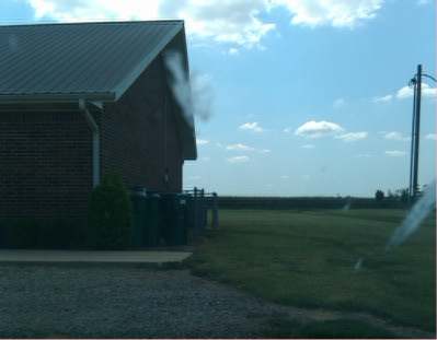
LAST ENUMERATION: All information has been taken from obituaries. ADD'L INFORMATION: This is a brand new cemetery, so not much else is known about it. PICTURE(S):
Search for names in this and other cemeteries.
Return to the map page.
Return to the list of cemeteries.
Return to the main Lamar County, TX page.
Special thanks to Jeff Kemp for designing the Lamar County banner. |
|
|
Copyright © 1996 —
— The Lamar County TX Website Team This website adheres to the NGS "Standards for Sharing Information with Others" regarding copyright, attribution, privacy, and the sharing of sensitive information. |