| |||
LOCATION: Tigertown Cemetery is located Highway 38 in the northwest quadrant of the county, in the community by the same name. It is in Block 28 of the Lamar County Road Map produced by American Drafting and Services revised December 1993. DIRECTIONS: The cemetery is 14.9 miles from Loop 286, west on Highway 79, to Farm Market Road 2820, through Hopewell community, to Highway 38, through Maxey Community to Tigertown. GPS COORDINATES: 33° 42' 30.59 N, 95° 48' 23.73 W
(33.7084972 Latitude and -95.8065917 Longitude)OLDEST KNOWN BURIAL: The oldest inscribed grave is that of Rodie Cothran, who died in 1862. NUMBER OF GRAVES: There are 708 known graves in the cemetery. (July 2017) SIGNS/MARKERS: There is a state highway marker for the cemetery. Historic Texas Cemetery: No Texas Historical Commission Marker: No
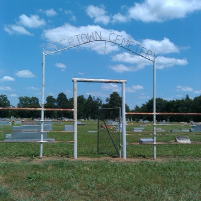
LAST ENUMERATION: The cemetery was recorded in November, 1991, by Ron Brothers, Patricia Ferguson, Ruth Renfro and Roberta Woods. The cemetery was photograped and updated in 2016 by Mary Hall Ferguson. ADD'L INFORMATION: The cemetery measures about 424 feet long and 340 feet wide. PICTURE(S): This cemetery photo is used with permission from Mary Hall Ferguson.
View pictures of the headstones.
Search for names in this and other cemeteries.
Return to the map page.
Return to the list of cemeteries.
Return to the main Lamar County, TX page.
Special thanks to Jeff Kemp for designing the Lamar County banner. |
|
|
Copyright © 1996 —
— The Lamar County TX Website Team This website adheres to the NGS "Standards for Sharing Information with Others" regarding copyright, attribution, privacy, and the sharing of sensitive information. |