| |||
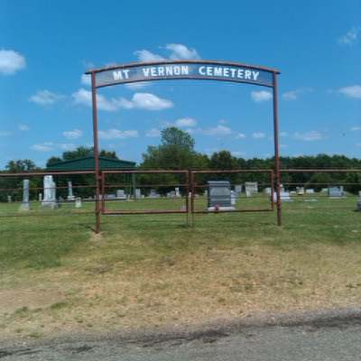
LOCATION: Mt. Vernon Cemetery was also known as Perryman Cemetery before the 1930's, as found in the records of J. W. Milligan, Pastor of Chicota Baptist Church. It is in Block 21 of the Lamar County Road Map produced by American Drafting and Services revised December 1993. DIRECTIONS: Cemetery is 2 miles southwest of the Globe community or 2 miles northeast of Maxey community. From Highway 38, turn north on CR 35400, proceed .7 miles and turn east on CR 34440. Proceed .6 miles and turn south on CR 34430. Cemetery is at that intersection. GPS COORDINATES: 33° 43' 33.66 N, 95° 44' 12.69 W
(33.7260167 Latitude and -95.7368583 Longitude)OLDEST KNOWN BURIAL: The oldest inscribed grave is that of Andrew Jackson Perryman who died in 1862. NUMBER OF GRAVES: There are 395 known graves in the cemetery. (July 2017) SIGNS/MARKERS: There is a state highway marker for the cemetery. Historic Texas Cemetery: No Texas Historical Commission Marker: No
LAST ENUMERATION: The cemetery was recorded by Debbie Burks in October, 1991. ADD'L INFORMATION: None. PICTURE(S):
View pictures of the headstones.
Search for names in this and other cemeteries.
Return to the map page.
Return to the list of cemeteries.
Return to the main Lamar County, TX page.
Special thanks to Jeff Kemp for designing the Lamar County banner. |
|
|
Copyright © 1996 —
— The Lamar County TX Website Team This website adheres to the NGS "Standards for Sharing Information with Others" regarding copyright, attribution, privacy, and the sharing of sensitive information. |