| |||
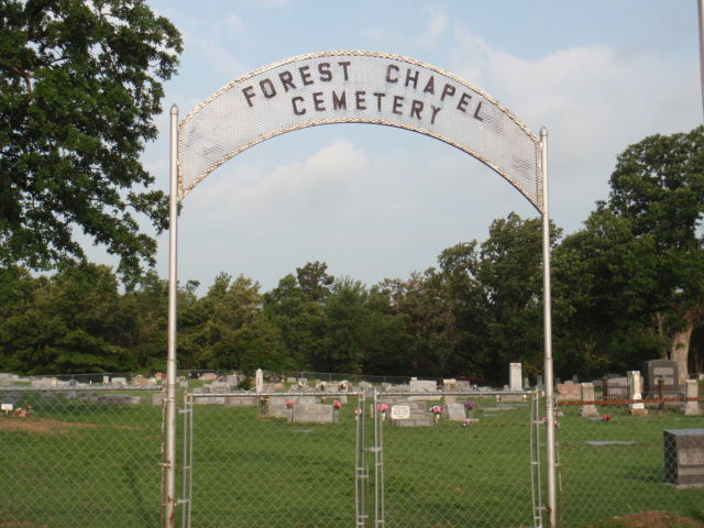
LOCATION: Forest Chapel Cemetery is located in the northwest quadrant of the county in the community that bears the same name. It is in Block 7 of the Lamar County Road Map produced by American Drafting and Services revised December 1993. DIRECTIONS: In Paris, at the intersection of Loop 286 North and Hwy 271 North, take Hwy 271 north for 12.8 miles to the intersection with FM 197 in Arthur City. Take FM 197 westerly for 5.3 miles to the intersection with CR 35750. The cemetery is on the right (or north) beside the Forest Chapel Methodist Church. GPS COORDINATES: 33° 51' 49.32" N, -95° 35' 39.12" W
(33.86370 Latitude -95.59420 Longitude)OLDEST KNOWN BURIAL: The oldest inscribed grave is that of Nettie Holder Long, who died 10 Jan 1870. NUMBER OF GRAVES: There are 1,412 known graves in the cemetery. (July 2017) SIGNS/MARKERS: There is not a state highway marker for the cemetery. LAST ENUMERATION: Forest Chapel Cemetery was last visited by Mary Hall Ferguson to update cemetery photos in June 2016. ADD'L INFORMATION: James Russell Hicks had been instrumental in locating many unknown graves and their related families. Ruth Renfro and Roberta J. Woods kept a permanent record of the burials, but all are deceased now. PICTURE(S): Photo below courtesy of Lawrence and Sue Dale.
View pictures of the headstones.
Search for names in this and other cemeteries.
Return to the map page.
Return to the list of cemeteries.
Return to the main Lamar County, TX page.
Special thanks to Jeff Kemp for designing the Lamar County banner. |
|
|
Copyright © 1996 —
— The Lamar County TX Website Team This website adheres to the NGS "Standards for Sharing Information with Others" regarding copyright, attribution, privacy, and the sharing of sensitive information. |