| |||
LOCATION: Click Cemetery is located in the southeast quadrant of the county in Block 48 of the Lamar County Road Map produced by American Drafting and Services revised December 1993. DIRECTIONS: The cemetery is on the John Robert Espy farm in the Viewpoint Community, on the original Republic of Texas land grant of Mathias Click. From FM 1497, three tenths of a mile down County Road 12650 and 200 yards east of County Road 12550 near the Viewpoint Community. This is PRIVATE PROPERTY and you must get permission before entering the property. GPS COORDINATES: 33° 34' 48.91 N, 95° 31' 44.34 W
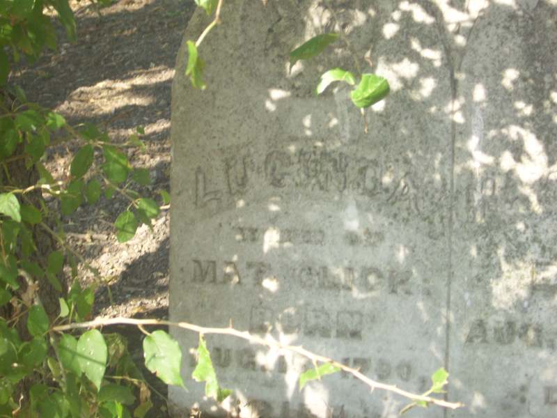
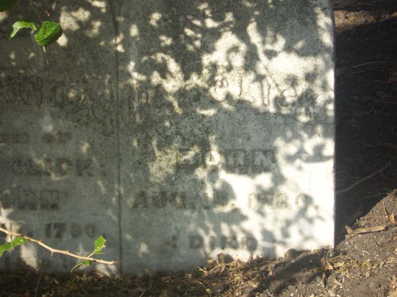
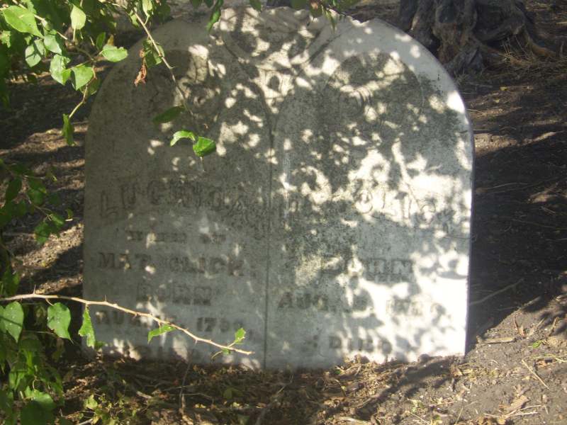
(33.58025278 Latitude and -95.5289833 Longitude)OLDEST KNOWN BURIAL: The oldest inscribed grave is that of Lucinda Betsy Cox Click who died 13 Apr 1875. NUMBER OF GRAVES: There are 2 known graves in the cemetery. (July 2017) SIGNS/MARKERS: There is not a sign for the cemetery. LAST ENUMERATION: The cemetery was photographed by Butch and Betsy Mills on August 7, 2011. ADD'L INFORMATION: The cemetery is on private property and permission must be obtained before entering the pasture. Photographs are included here to assist the researcher without having to visit the cemetery. At one time the cemetery contained evidence of many burials but only the double marker of Mathias and Lucinda Click exists now. Mr. Espy has allowed a descendant to fence the one remaining headstone with a sturdy pipe fence. The inscriptions are as follows: Mathias Click 16 Aug 1786 - 15 May 1861 and Lucinda Betsy Cox Click 15 Aug 1790 - 13 Apr 1875. The cemetery was recorded by Elizabeth Booth in the 1970's. PICTURE(S):
Search for names in this and other cemeteries.
Return to the map page.
Return to the list of cemeteries.
Return to the main Lamar County, TX page.
Special thanks to Jeff Kemp for designing the Lamar County banner. |
|
|
Copyright © 1996 —
— The Lamar County TX Website Team This website adheres to the NGS "Standards for Sharing Information with Others" regarding copyright, attribution, privacy, and the sharing of sensitive information. |